PRELIMINARY MAPS FOR BAER ASSESSMENT:
09/03/2014: The maps below are working maps for soil burn severity on the Hansel Fire, the Duncan Fire, the Chiwaukum Creek Fire, and the Carlton South BAER team assessments. These validated maps are being used by the BAER team to estimate post-fire runoff and erosion, potential impacts to values at risk, identification of emergency treatments, and recommended risk-reduction projects. Click on any map below for a larger view.
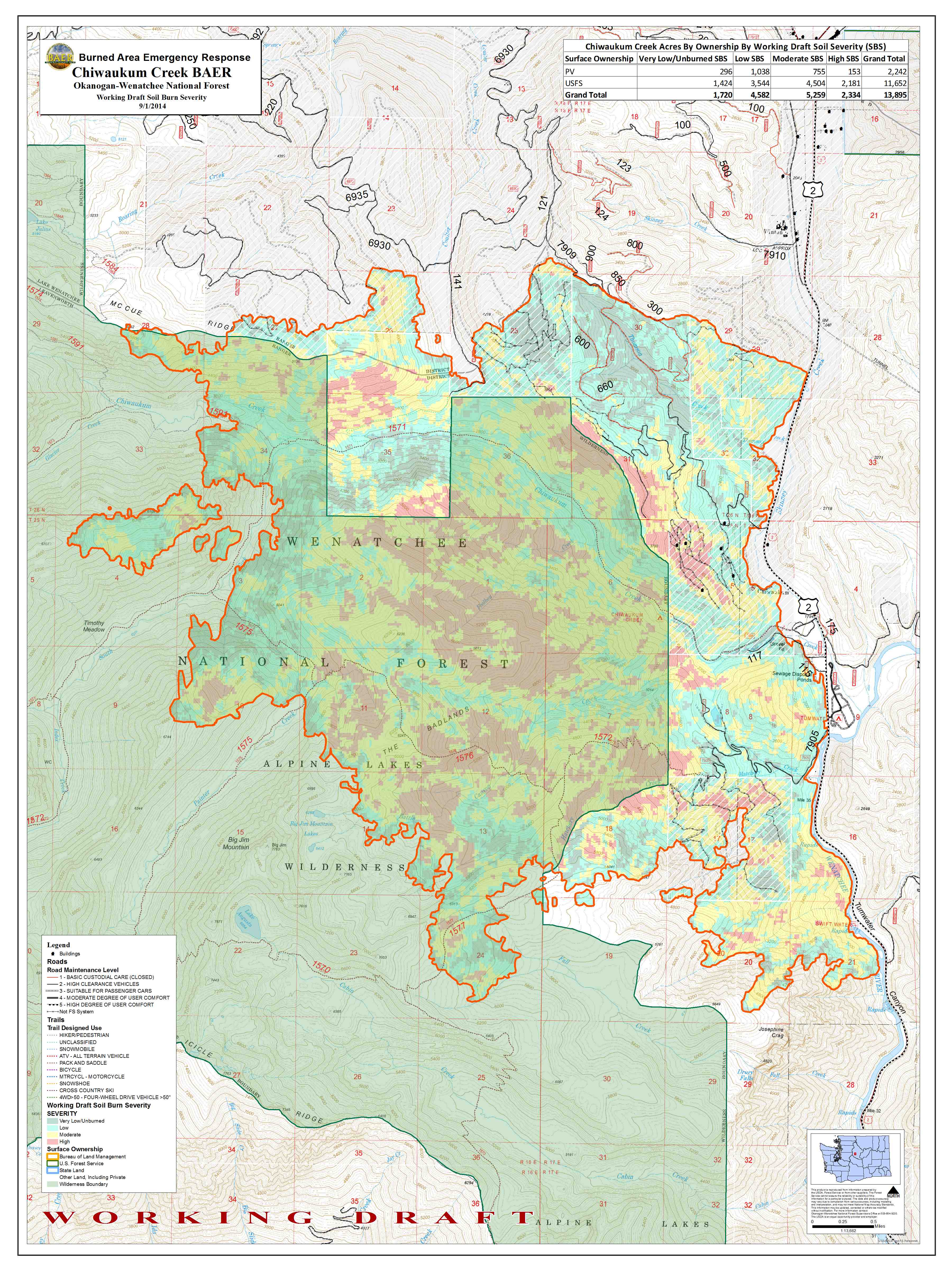
Chiwaukum Soil Burn Severity Map 09/03/2014

Carlton Complex, south, soil burn severity map.
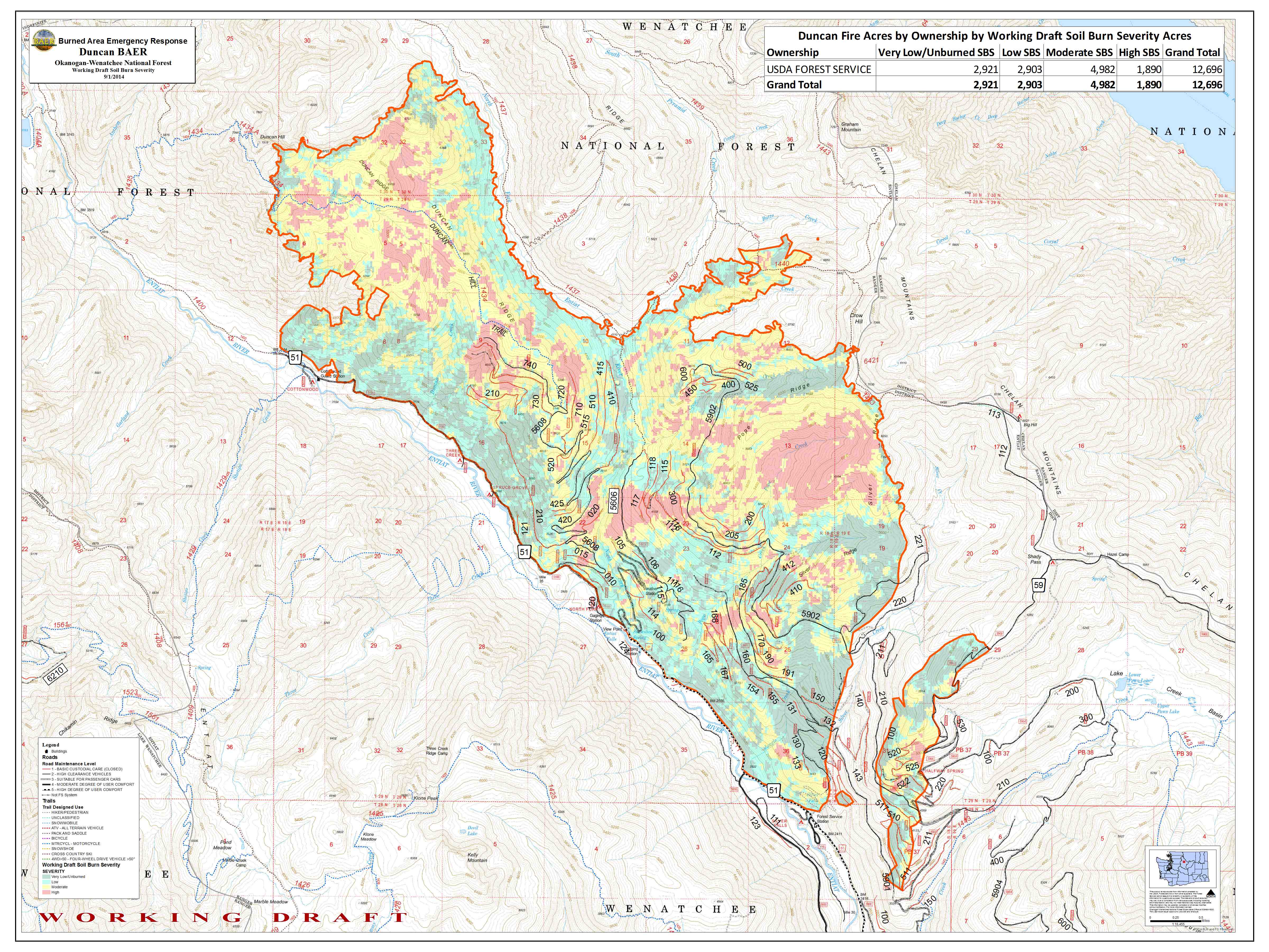
Duncan Fire BAER assessment, soil burn severity map.
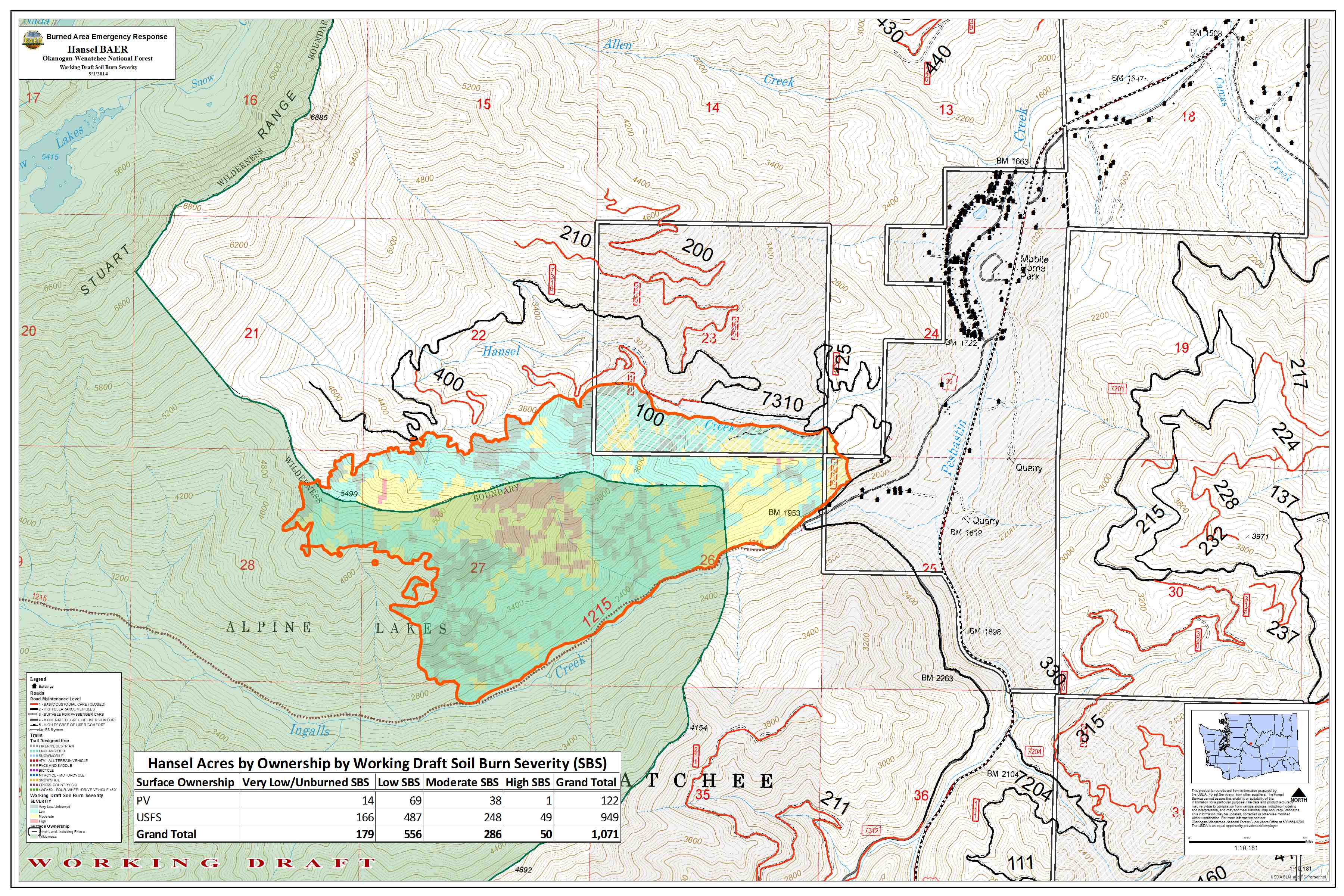
Hansel Fire BAER assessment, soil burn severity map.
08/05/2014 PRELIMINARY LANDSLIDE HAZARD MAP
2014 Mills Canyon Complex Fire – Chelan County, Washington
The Central Washington 2014 BAER TEAM compiled the interactive map below, illustrating estimated probability of debris flow (in percentages) along with potential volume of debris flow in cubic meters and the combined relative hazard of debris flow for the mapped areas of the Mills Canyon Complex. Views on the map are visible for the drainage basin and for individual stream segments. Estimates are based on a 25-year recurrence interval, i.e. there’s a 1-in-25 chance of a storm of this magnitude occuring in any year. Click on the map, then you can view the team’s predictions by clicking at top right of the larger linked map to see the different levels. More info on calculation of the predictions is available on the USGS Scientific Background page.
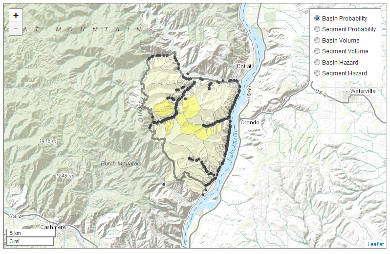
2014 Mills Canyon Complex Preliminary Landslide Hazard Assessment
NOTE: IF YOU LIVE IN OR ARE VISITING AN AREA WITH LANDSLIDE RISK, detailed information is available [HERE].
07/30/2014 *DRAFT* BURN SEVERITY MAP
(click to enlarge)

MILLS CANYON SOIL BURN SEVERITY *DRAFT* MAP