Reports
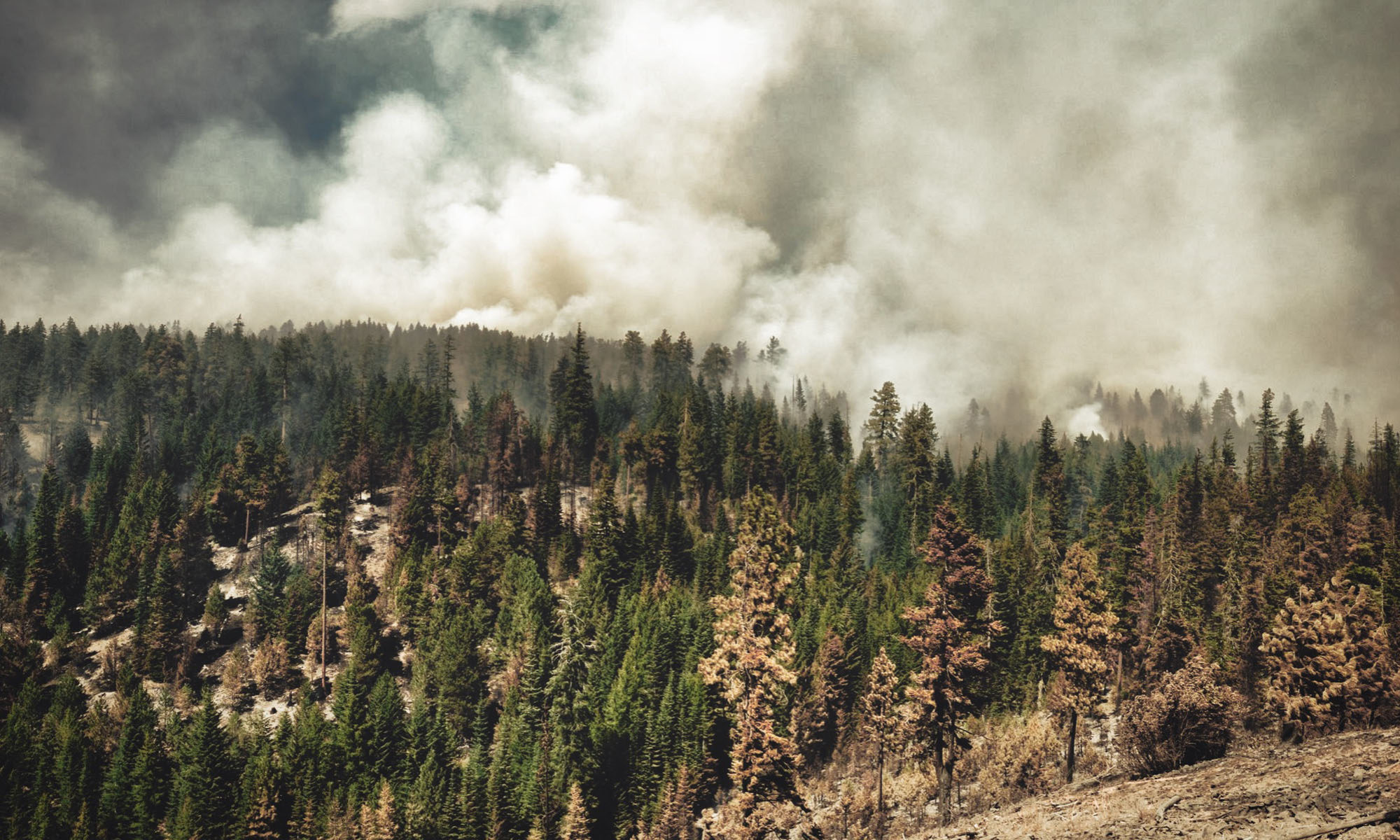
Left Hand Fire Burned Area Summary
Left Hand Fire Values at Risk Matrix and Treatments
Maps
Left Hand Fire Treatment Recommendation Map
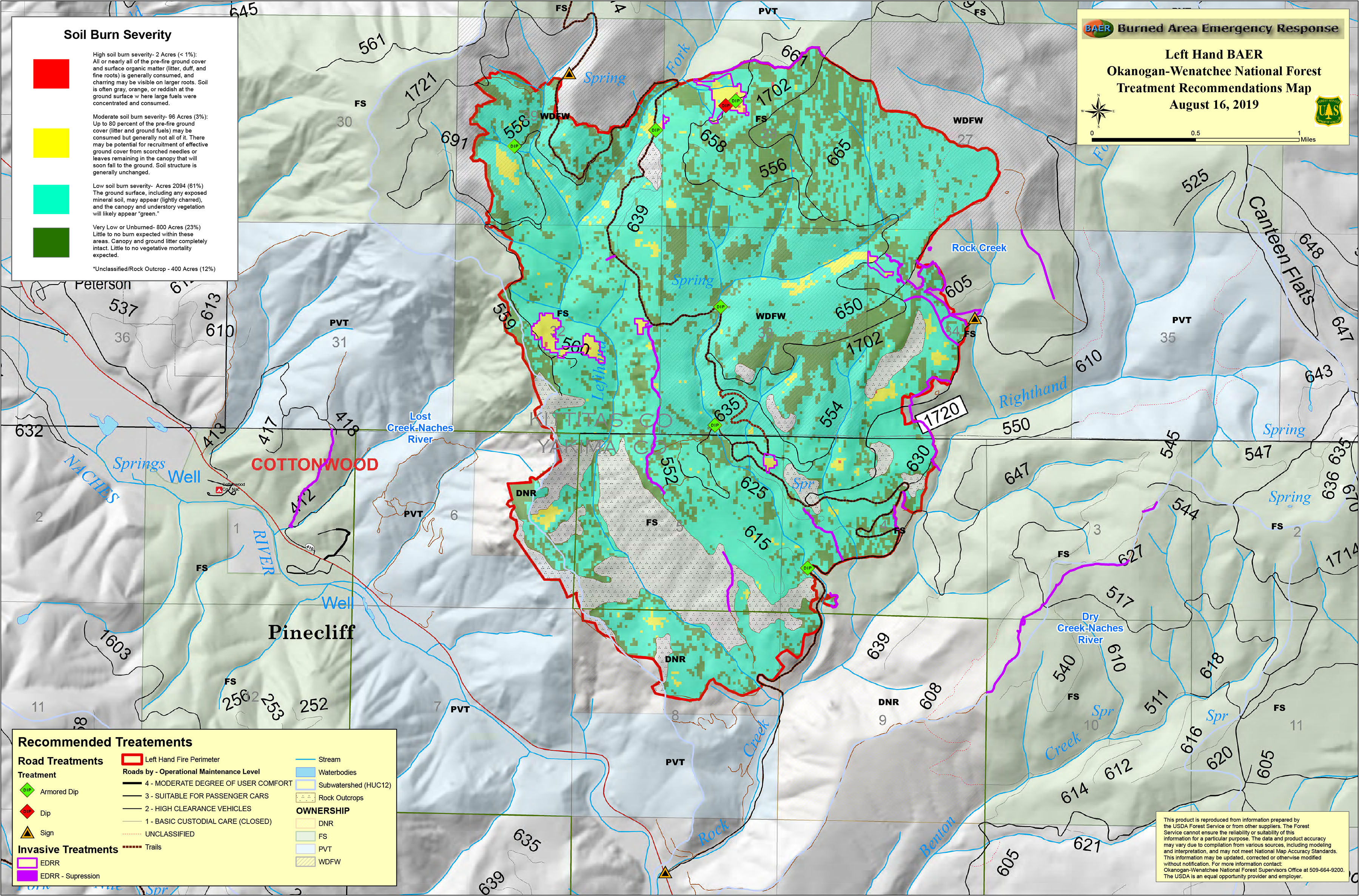
- KMZ files are also available to view the maps in greater detail in Google Earth (and many other mapping programs). Download the KMZ zip file, then double-click it to extract the KMZ files and save to your computer. Open the Google Earth program. [ If you don’t already have Google Earth, you can download and install it for free HERE. ] Drag the KMZ file onto the Google Earth program icon or main screen (or in Google Earth, click File, Import and select the KMZ file). After the KMZ file loads, you can zoom way in for more detail, change the angle of view, show or hide layers, and adjust transparency of layers.
Soil Burn Severity Map
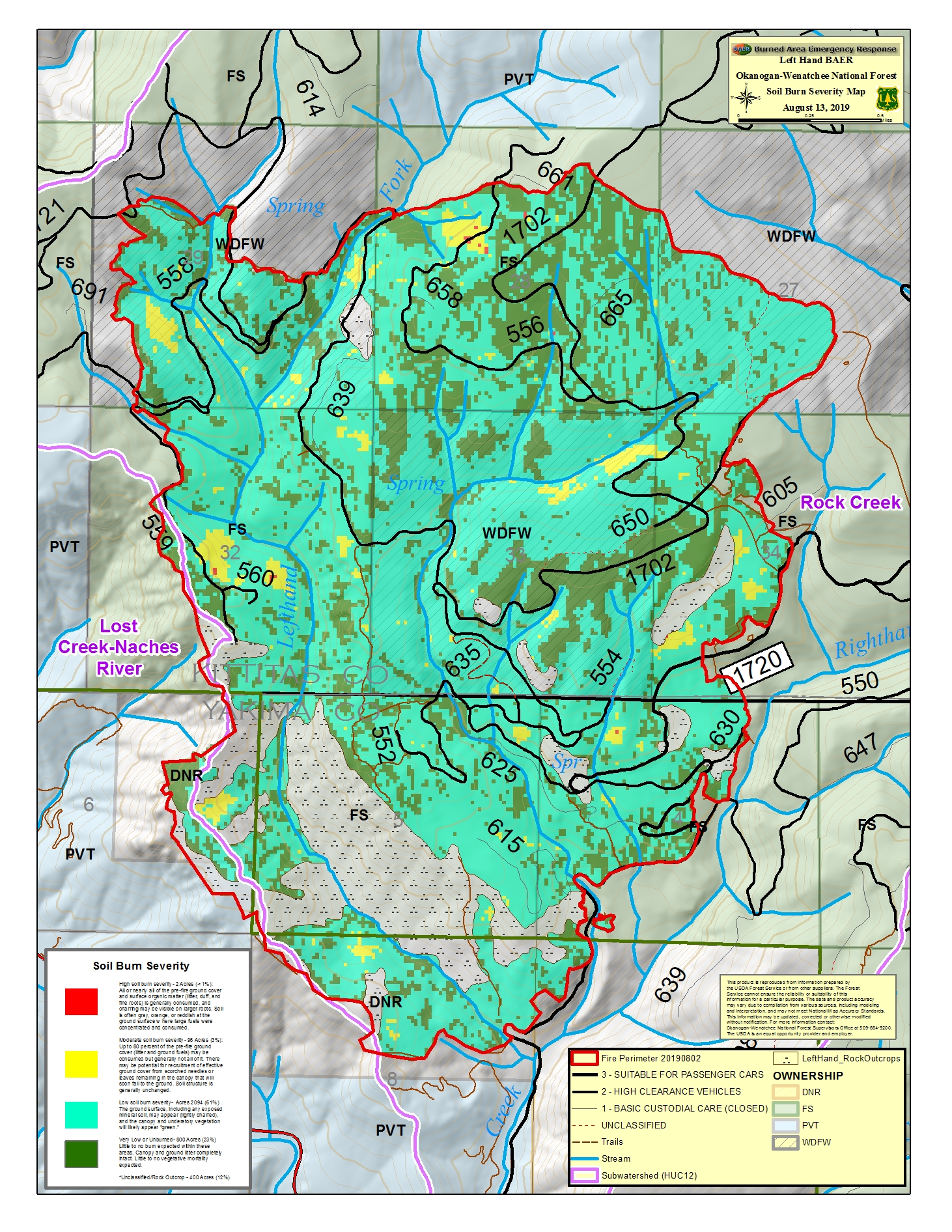
- KMZ files are also available to view the maps in greater detail in Google Earth (and many other mapping programs). Download the KMZ zip file, then double-click it to extract the KMZ files and save to your computer. Open the Google Earth program. [ If you don’t already have Google Earth, you can download and install it for free HERE. ] Drag the KMZ file onto the Google Earth program icon or main screen (or in Google Earth, click File, Import and select the KMZ file). After the KMZ file loads, you can zoom way in for more detail, change the angle of view, show or hide layers, and adjust transparency of layers.
More Information on Burn Severity Levels
Field Guide for Mapping Post-Fire Soil Burn Severity
Disclaimer: This product is reproduced from information prepared by the USDA Forest Service or from other suppliers. The Forest Service cannot ensure the reliability or suitability of this information for a particular purpose. The data and product accuracy may vary due to compilation from various sources, including modeling and interpretation, and may not meet National Map Accuracy Standards. This information may be updated, corrected or otherwise modified without notification.